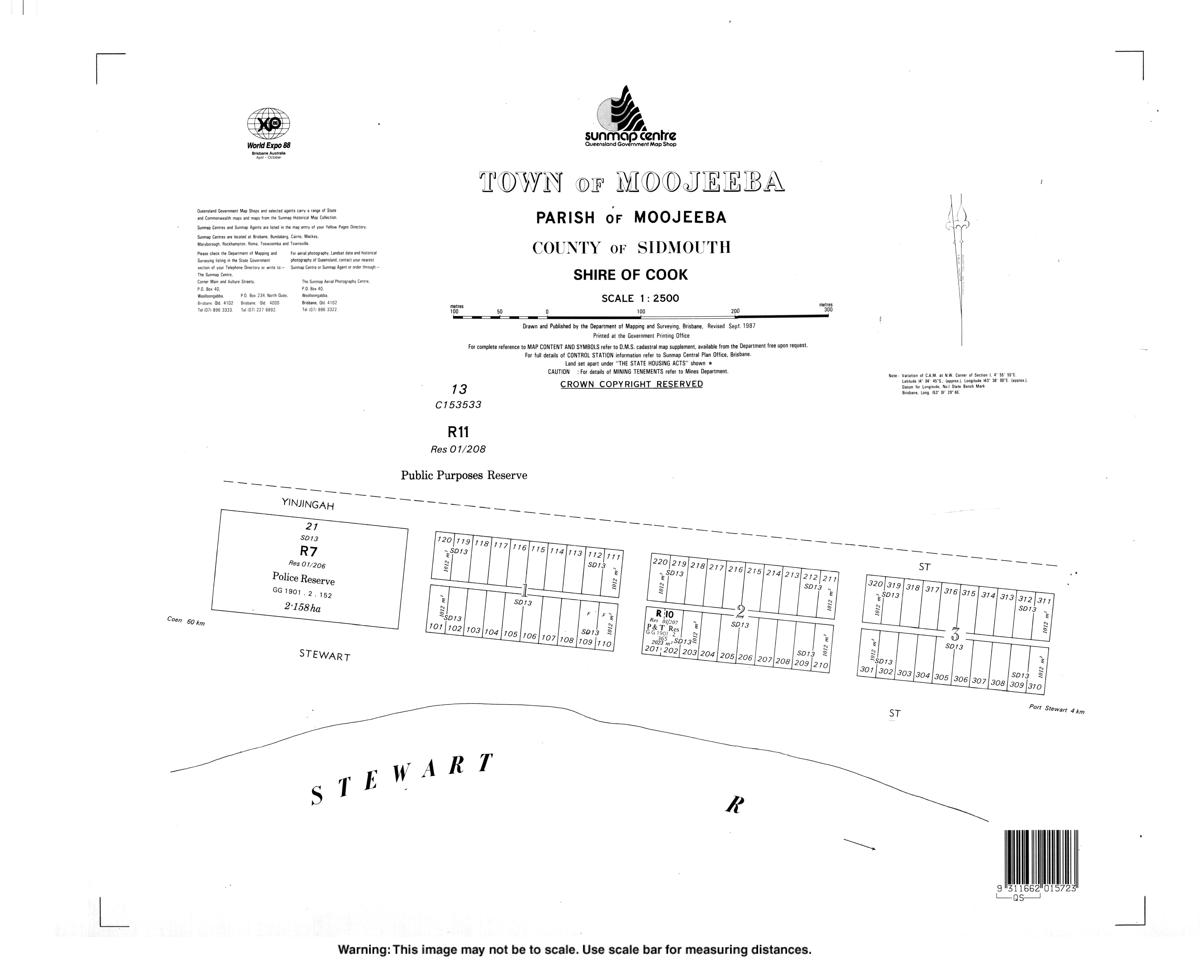
Moojeeba, Queensland
Moojeeba | |
|---|---|
Moojeeba | |
| Coordinates: 14°04′45″S 143°38′55″E / 14.0791°S 143.6486°E | |
| Country | Australia |
| State | Queensland |
| LGA | |
| Location | |
| Government | |
| • State electorate | |
| • Federal division | |
| Time zone | UTC+10:00 (AEST) |
Moojeeba is a town in the Shire of Cook, Queensland, Australia.[1] The town is within the locality of Coen.[2]
History
The Town of Moojeeba is present on a 1900 survey plan.[1]
As at January 2021, Moojeeba has no buildings.[3]
External links
References
- ^ a b "Moojeeba – population centre in Cook Shire (entry 22585)". Queensland Place Names. Queensland Government. Retrieved 8 January 2020.
- ^ "Queensland Globe". State of Queensland. Retrieved 8 January 2020.
- ^ "Queensland Globe". State of Queensland. Retrieved 15 January 2021.