Malbon, Queensland
Malbon | |
|---|---|
Streetscape, Malbon, circa 1940 | |
Malbon | |
| Coordinates: 21°04′27″S 140°18′05″E / 21.0741°S 140.3013°E | |
| Country | Australia |
| State | Queensland |
| City | Kuridala |
| LGA | |
| Location |
|
| Government | |
| • State electorate | |
| • Federal division | |
| Time zone | UTC+10:00 (AEST) |
| Postcode | 4824 |
Malbon is a town in the locality of Kuridala in the Shire of Cloncurry, Queensland, Australia.[1]
History
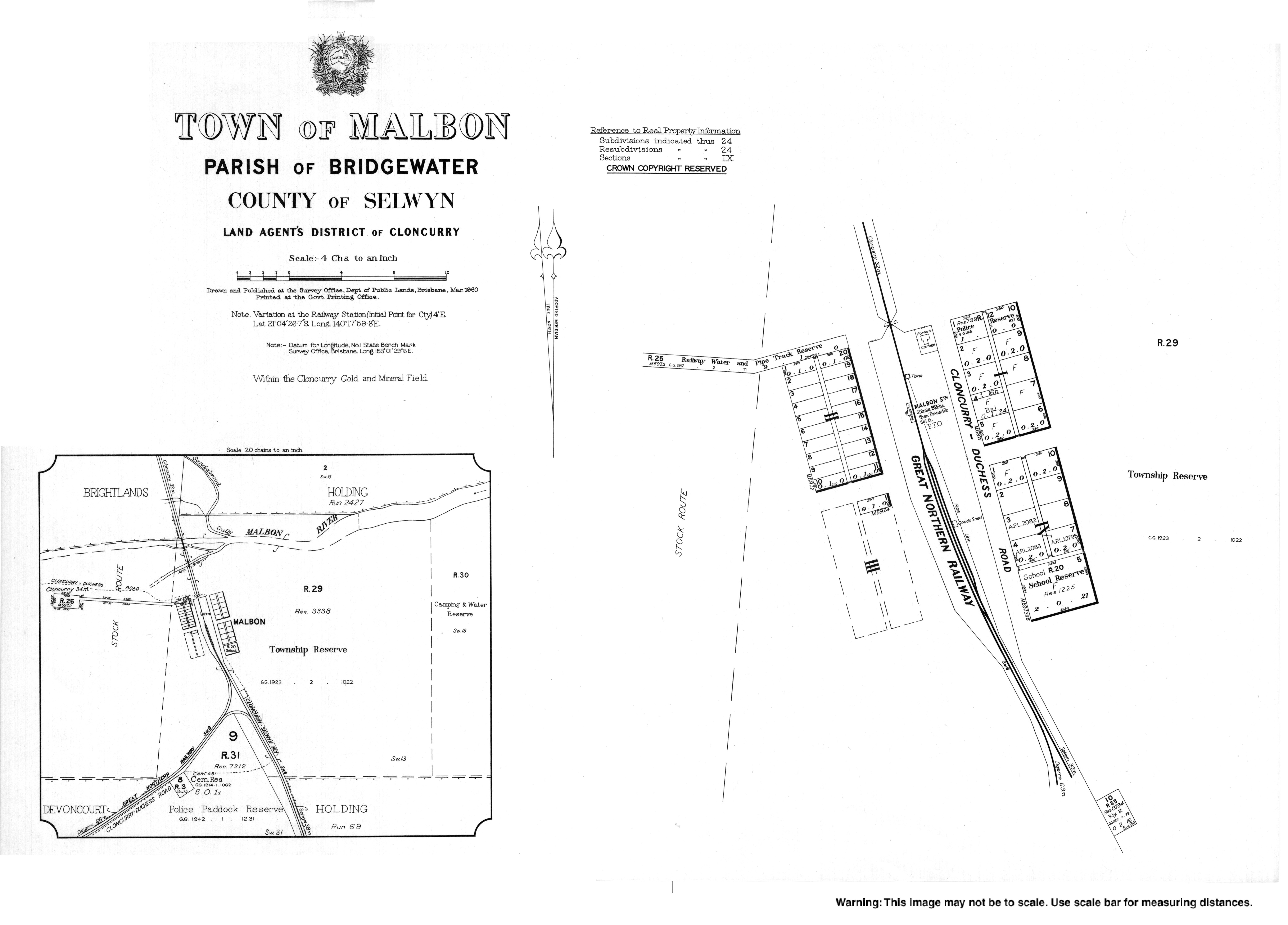
The Town of Malbon is shown on a 1910 survey plan.[1]
Malbon Provisional School opened on 7 November 1911. It became Malbon State School on 1 June 1916. It closed on 8 August 1969.[2] The school was located at the southern end of town on the Malbon Selwyn Road (21°04′31″S 140°18′07″E / 21.0754°S 140.3019°E).[3]
References
- ^ a b "Malbon – town in Shire of Cloncurry (entry 20691)". Queensland Place Names. Queensland Government. Retrieved 1 January 2018.
- ^ Queensland Family History Society (2010), Queensland schools past and present (Version 1.01 ed.), Queensland Family History Society, ISBN 978-1-921171-26-0
- ^ "Town map of Malbon". Queensland Government. 1960. Archived from the original on 6 January 2018. Retrieved 6 January 2018.
External links
Wikimedia Commons has media related to Malbon, Queensland.