Chorzowska Street
Start of Chorzowska Street at Jerzy Ziętek Square | |
Interactive map of Chorzowska Street | |
| Former name(s) | Königshütter Straße (until 1922, 1939–1945) Szosa Królewsko-Hucka (1924–1939) |
|---|---|
| Part of | Dąb, Koszutka, Osiedle Tysiąclecia, Śródmieście |
| Length | 4,810 m (15,780 ft) |
| Location | Katowice, Poland |
| Coordinates | 50°16′20.6″N 18°59′29.2″E / 50.272389°N 18.991444°E |
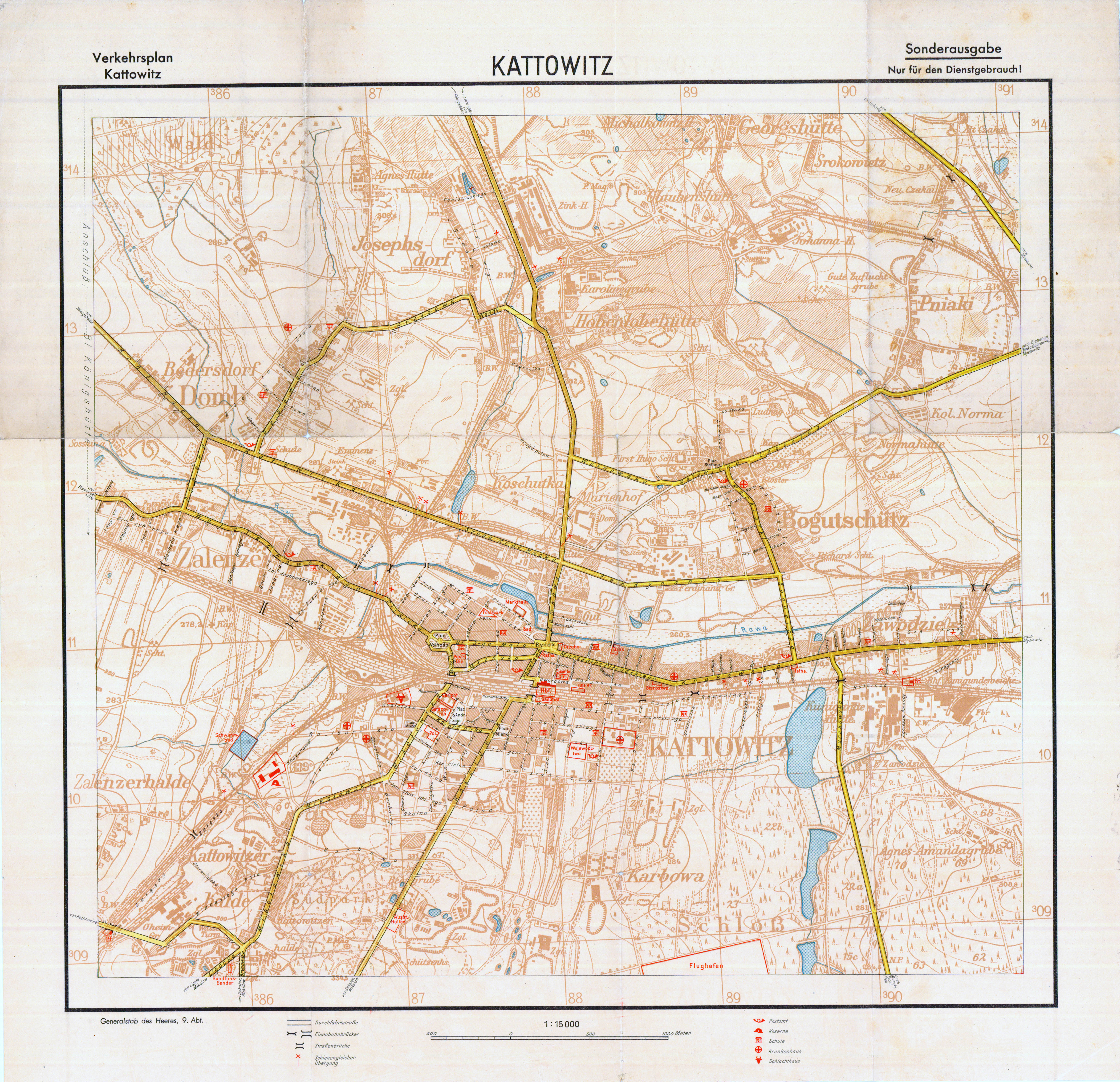
Chorzowska Street in Katowice is a key road in the Metropolis GZM, located in the districts of Dąb, Koszutka, Osiedle Tysiąclecia, and Śródmieście. It serves as a direct road link between Katowice's city center and Chorzów, from which it derives its name. The street is part of National Road 79 along its entire length. Tram tracks, in place since 1897, run along the street. Between 2002 and 2007, the section including Walenty Roździeński Avenue, Jerzy Ziętek Square, and Chorzowska Street was redeveloped to accommodate the Central Road Route. The street is lined with high-rise buildings, office complexes, and the Silesia City Center shopping center.
Route
Chorzowska Street begins at Jerzy Ziętek Square (intersection of Wojciech Korfanty Avenue and Walenty Roździeński Avenue).[1] It intersects with Sokolska Street.[2] At the junction with Jan Nepomucen Stęślicki Street and Friedrich Wilhelm Grundmann Street (the so-called "city center bypass", near Alojzy Budniok Park), there is an exit from the tunnel under the roundabout.[1] This includes two tunnels, 672 m and 657 m long, facilitating east–west transit between Chorzowska Street and Walenty Roździeński Avenue. The street continues past Piotr Ściegienny Street, John Baildon Street, and Dębowa Street. Before the intersection with Złota Street and Bracka Street (Atrakcji Square), there is an exit to the Nikodem and Józef Reniec Route.[3][4]
Further along, Chorzowska Street forms the boundary between Chorzów and Katowice, serving as the northern boundary of Katowice's Osiedle Tysiąclecia and the southern boundary of Chorzów's Silesian Park. It ends at the city border, near a pedestrian path to Silesian Stadium, where it becomes Katowicka Street.[5]
History
From the late 18th to the mid-19th century, industrial complexes were enclaves in a still-rural landscape. The development of industry led to the regulation of some roads and the creation of new ones, which became significant for the city's future urban framework. Industrial complexes gradually disappeared from the city's map, and within its original cadastral boundaries, no smelters or mines remain today due to urbanization.[6] Industrial functions gave way to those typical of an expanding urban center, where industry management hubs concentrated. Regulated straight sections of early industrial roads and rural paths were incorporated into the urban street network. Two main communication axes – east-west (now Chorzowska Street and further Warszawska Street) and north–south (now Wojciech Korfanty Avenue, Pocztowa Street, and Tadeusz Kościuszko Street) – formed the main urban framework of Śródmieście.[6]
The road from Katowice to Królewska Huta (now Chorzów) was well-established by the first half of the 19th century, routed behind the former pond of the Marta Smelter.[7] On 1 January 1828, a wooden building for the first school in Dąb was opened at 153 Chorzowska Street, expanded in the 1840s and replaced with a new brick building in 1856 at the same location.[8] In 1870, the Kattowitz–Königshütter Chausee-Aktien Verein company improved the road.[9] In 1897, a tram line to Królewska Huta was established, initially served by steam trams,[10] and from 1907 by electric trams to Bytom.[7]
During the Second Silesian Uprising in August 1920, fighting between Polish insurgents and Germans occurred near Dąb along the road to Królewska Huta.[8] The street was named Königshütter Straße until 1922 and from 1939 to 1945, and Szosa Królewsko-Hucka from 1924 to 1939.[11] During the interwar period, a carbide lamp burner factory operated at number 179.[8] Between 1933 and 1934, four residential blocks for the homeless were built at numbers 240, 242, 244, and 246 as part of affordable social housing. At number 153, a post and telegraph office and a police station operated during the interwar period.[12]
During the Polish People's Republic, the street was part of the international road E22a.[13] It was named after Felix Dzerzhinsky.[14][15] In the late 1960s, a complex of commercial pavilions and residential buildings, designed by Stanisław Kwaśniewicz, was built on the northern side in the Koszutka area.[10][16] Named after Julian Marchlewski, this estate was part of the city's general urban and architectural reorganization plan.[7]
From 1963 to 2003, the Baildon Hall, with its distinctive 50 cables supporting the roof, stood at the intersection of Żelazna Street and Chorzowska Street. One cable was damaged in 1996, and in April 2003, a private company demolished the hall.[17]
From 1985 to 2000, the street was part of the former national road 914.[18]
Between 2002 and 2007, the section of Walenty Roździeński Avenue, Jerzy Ziętek Square, and Chorzowska Street was redeveloped for the Central Road Route.[2] The Orląt Lwowskich Viaduct,[19] 592 m long and 31.12 m wide in an "S" shape, was built over Bracka Street.[20] It connects Chorzowska Street to the Nikodem and Józef Reniec Route.[21] On 3 August 2010, the street was part of the third stage of the 2010 Tour de Pologne, and on 2 August 2011, the third stage of the 2011 Tour de Pologne.[22]
Infrastructure
Near the central headquarters of ING Bank Śląski, the so-called "Western Gate" marks one of the entrances to the city center,[23] symbolizing the boundary of the downtown area.[6]
A 2007 study for the Katowice City Office found that during the afternoon peak, traffic volume on Chorzowska Street from Piastów Street to Bracka Street was 3,279 vehicles (89.5% passenger cars, 6.4% vans, 2.4% trucks, 1% buses), and near Silesia City Center, 6,245 vehicles (91.8% passenger cars, 3.9% vans, 1.5% trucks, 1.3% buses).[23] Noise levels along Chorzowska Street range from 70.6 dB to 74.3 dB, and near the tram line, from 60.8 dB to 73 dB.[24]
The street includes a northern water main (Dn 800/600 Maczki–Katowice)[24] with a 600 mm diameter,[25] a district heating main (PEC – 2 x Dn 700), and a medium-pressure gas pipeline (Ø 225 mm).[26]
Buildings and institutions
The following notable buildings are located along Chorzowska Street:
- Bank Pekao building (1 Chorzowska Street) – built in 1995 to a 1992 design by Gabriel Korbutt and Krzysztof A. Kałużny. It has a usable area of 3,600 m2 and a volume of 20,100 m3. The architects received the 1995 Katowice Voivode's First Prize and the SARP "Architecture of the Year 1995" award.[27]
- Chorzowska 50 – a Class A office building at 50 Chorzowska Street, built from 1999 to 2001. It has 13 floors, a height of 68 m, and a total area of 40,300 m2. The building's intensity ratio is 4.15. Considered a city "landmark" by local authorities, its 2.22 ha area was included in the Katowice Special Economic Zone by a 2 November 2006 Council of Ministers regulation.[23][28]
- Baildon Steelworks complex – located between Chorzowska Street, Friedrich W. Grundmann Street, Żelazna Street, Gliwicka Street, and Feliks Bocheński Street.[23]
- Silesia City Center (107 Chorzowska Street) – a commercial-service complex on the site of the former Gottwald Coal Mine, opened on 18 November 2005. With 65,000 m2, it houses stores like Cinema City Silesia, Empik, Saturn, and Fun-City. The investor was the Hungarian TriGranit Development Corporation, which also developed Dębowe Tarasy.[29]
- Chapel of St. Barbara at Silesia City Center (111 Chorzowska Street) – consecrated in 2005, housed in a building that once contained a hoisting machine for the Kleofas Coal Mine. It is a branch of the Parish of St. John and Paul Martyrs in Dąb.[30]
- Former Kleofas Coal Mine buildings at Silesia City Center (109 Chorzowska Street): the former administration building and the Jerzy shaft hoisting tower, both under conservation protection.[31]
- Katowice Business Point (corner of Chorzowska Street and Piotr Ściegienny Street) – an office and conference building with commercial-service functions, built from 2008 to 2010. It has 11 above-ground and 3 underground floors, 17,200 m2 of usable area, and 200 parking spaces.[32] Designed by Jaspers Eyers & Partners (Belgium) and Konior & Partners (Poland).[33]
- Craft (105 Chorzowska Street) – an office building constructed from 2020 to 2023, 55 m tall, consisting of three perpendicular structures clad in copper-toned elements. The investor was Ghelamco Poland.[34]
- Former Baildon Smelter administrative building (112 Chorzowska Street), built in the early 20th century in the historicism style, and a water tower (near number 112), also from the early 20th century.[31]
- Church of St. John and Paul Martyrs complex (160 Chorzowska Street), listed in the Registry of Cultural Property on 20 April 2004 (no. A/115/04). The complex includes the church (built in 1873, rebuilt between 1901 and 1902 per Ludwig Schneider's design), a sculptural group "Crucifixion" from the early 20th century, a rectory (built between 1897 and 1899), and a church cemetery (within the fenced plot).[35]
- Historic tenement in a garden (186 Chorzowska Street), built in the International Style, under conservation protection.[36]
- Historic water pumping station and reservoir of the Upper Silesian Waterworks (186a Chorzowska Street),[37] built in the historicism style, under conservation protection.[36]
- Villa in a garden (188 Chorzowska Street), built in the late 1920s to early 1930s.[31]
- Historic tenements in gardens (200 and 202 Chorzowska Street), built in the late 19th century in the brick historicism style,[31] under conservation protection.[36]
Other institutions along Chorzowska Street include: commercial and service businesses, shops, the Człowiek dla Człowieka Foundation, the Kpda Foundation for Accounting Development, medical warehouses, branches of Post Office No. 1, and housing associations.[38]
References
- ^ a b Cieślicki, Igor (11 June 2003). "Średnicówka na finiszu" [Central Road Route Nearing Completion]. www.katowice.naszemiasto.pl (in Polish). Retrieved 23 September 2025.
- ^ a b "Od dziś ulica Sokolska jest nieprzejezdna" [From Today, Sokolska Street is Closed to Traffic]. www.katowice.naszemiasto.pl (in Polish). 27 May 2005. Retrieved 23 September 2025.
- ^ "Trasa imienia Nikodema i Józefa Renców" [Nikodem and Józef Reniec Route]. www.katowice.eu (in Polish).
{{cite web}}: CS1 maint: deprecated archival service (link) - ^ Katowice – Plan miasta [Katowice – City Map] (in Polish). Warsaw: Demart SA. 2009–2010. ISBN 9788389239969.
- ^ Okręg Katowicki – Plany miast [Katowice Region – City Maps] (in Polish). Warsaw: Demart SA. 2009.
- ^ a b c "Lokalny Program rewitalizacji miasta Katowice na lata 2007-2013" [Local Revitalization Program for Katowice 2007-2013] (PDF). www.bip.um.katowice.pl (in Polish). Archived from the original (PDF) on 22 July 2016.
- ^ a b c Szaflarski, Józef, ed. (1978). Katowice 1865–1945. Zarys rozwoju miasta [Katowice 1865–1945. Outline of the City's Development] (in Polish). Katowice: Śląsk. pp. 25, 64–65, 87.
- ^ a b c Rzewiczok, Urszula (1999). Dzieje Dębu (1299-1999): monografia historyczna dzielnicy Katowic [History of Dąb (1299-1999): Historical Monograph of a Katowice District] (in Polish). Katowice: Muzeum Historii Katowic. pp. 36, 52, 71. ISBN 83-87727-30-X.
- ^ Bulsa, Michał (2012). Ulice i place Katowic [Streets and Squares of Katowice] (in Polish). Katowice: Prasa i Książka. p. 51. ISBN 978-83-933-665-8-3.
- ^ a b Szaraniec, Lech (1996). Osady i osiedla Katowic [Settlements and Estates of Katowice] (in Polish). Katowice: Artur. pp. 26, 138–139. ISBN 83-905115-0-9.
- ^ "Niemiecka mapa Katowic z 1939" [German Map of Katowice from 1939]. www.mapywig.org (in Polish). Retrieved 23 September 2025.
- ^ Janota, Wojciech (2010). Katowice między wojnami. Miasto i jego sprawy 1922-1939 [Katowice Between the Wars. The City and Its Affairs 1922-1939] (in Polish). Łódź: Księży Młyn. pp. 35, 47, 67. ISBN 978-83-7729-021-7.
- ^ Samochodowy atlas Polski 1:500 000 [Road Atlas of Poland 1:500,000] (in Polish) (9th ed.). Warsaw: Państwowe Przedsiębiorstwo Wydawnictw Kartograficznych. 1985. p. 126.
- ^ "Straßenverzeichnis aller Straßen von Kattowitz" [List of All Streets in Katowice] (PDF). www.grytzka-genealogie.de (in German). Archived from the original (PDF) on 12 August 2011.
- ^ "Alle Straßen bzw. Straßennamen von Kattowitz Deutsch – Polnisch" [All Streets and Street Names of Katowice German–Polish]. www.grytzka-genealogie.de (in German). Archived from the original on 19 July 2011.
- ^ Adamczyk, S., ed. (1993). Katowice – Informator [Katowice – Guide] (in Polish). Katowice: Urząd Miasta w Katowicach. p. 26.
- ^ Bulsa, Michał; Szmatloch, Barbara (2019). Katowice, których nie ma [Katowice That No Longer Exist] (in Polish). Łódź: Księży Młyn. p. 19. ISBN 9788377295021.
- ^ Polska: Atlas samochodowy 1:300 000 [Poland: Road Atlas 1:300,000] (in Polish) (1st ed.). Warsaw: Polskie Przedsiębiorstwo Wydawnictw Kartograficznych. 1992. ISBN 83-7000-080-0.
- ^ "Estakada Orląt Lwowskich" [Orląt Lwowskich Viaduct]. www.katowice.eu (in Polish). Retrieved 23 September 2025.
- ^ "Estakada w ciągu Drogowej Trasy Średnicowej nad ulicą Bracką w Katowicach" [Viaduct in the Central Road Route over Bracka Street in Katowice]. www.4pm.pl (in Polish). Archived from the original on 22 October 2012.
- ^ "Tramwajowa linia turystyczna: Zobacz dokąd możesz dojechać zabytkowym tramwajem" [Tram Tourist Line: See Where You Can Travel with a Historic Tram]. www.turystyczna.wpk.katowice.pl (in Polish). Archived from the original on 4 March 2016.
- ^ "Tour de Pologne w Katowicach 2011. Zobacz, gdzie pojadą kolarze" [Tour de Pologne in Katowice 2011. See Where the Cyclists Will Ride]. www.katowice.naszemiasto.pl (in Polish). 19 July 2011. Retrieved 23 September 2025.
- ^ a b c d "Studium uwarunkowań i kierunków zagospodarowania przestrzennego, Cz. 1, Uwarunkowania zagospodarowania przestrzennego" [Study of Conditions and Directions for Spatial Development, Part 1, Conditions for Spatial Development] (PDF). www.bip.um.katowice.pl (in Polish). Archived from the original (PDF) on 8 March 2016.
- ^ a b Raport o stanie miasta Katowice 2005 [Report on the State of Katowice City 2005] (PDF) (in Polish). 2005. Archived from the original (PDF) on 5 March 2016. Retrieved 23 September 2025.
- ^ "Miejscowy plan zagospodarowania przestrzennego terenu położonego w rejonie ulic: Bracka − Chorzowska − Żelazna w Katowicach" [Local Spatial Development Plan for the Area Around Bracka, Chorzowska, and Żelazna Streets in Katowice] (PDF). www.bip.katowice.eu (in Polish). 31 July 2006. Archived (PDF) from the original on 26 April 2017.
- ^ "Miejscowy plan ogólnego zagospodarowania przestrzennego miasta Katowice dla terenu położonego w obszarze dzielnicy Osiedle 1000-lecia - Załęże w rejonie ulic: Bracka - Chorzowska - Żelazna w zakresie wprowadzenia funkcji handlu, usług, administracji i sportu oraz adaptacji istniejącej funkcji przemysłowej" [General Spatial Development Plan for Katowice for the Area in the Osiedle Tysiąclecia - Załęże District Around Bracka, Chorzowska, and Żelazna Streets for the Introduction of Commercial, Service, Administrative, and Sports Functions and Adaptation of Existing Industrial Functions] (PDF). www.bip.katowice.eu (in Polish). 22 December 2003. Archived (PDF) from the original on 26 April 2017.
- ^ Taczewski, Tomasz (2002). Współczesna architektura Katowic [Contemporary Architecture of Katowice] (in Polish). Katowice: GIA. pp. 123, 126. ISBN 83-904135-2-3.
- ^ "Strona główna" [Home Page]. www.chorzowska50.pl (in Polish). Archived from the original on 10 August 2015.
- ^ "Oficjalna strona internetowa" [Official Website]. www.silesiacitycenter.com.pl (in Polish). Retrieved 23 September 2025.
- ^ "Wycinek historyczny" [Historical Excerpt]. www.kaplica.silesiacitycenter.com.pl (in Polish). Archived from the original on 26 April 2009.
- ^ a b c d "Wartości dziedzictwa kulturowego (załącznik 1.9)" [Values of Cultural Heritage (Annex 1.9)] (PDF). www.bip.um.katowice.pl (in Polish). Archived from the original (PDF) on 4 March 2016.
- ^ "Katowice Business Point". www.urbanity.pl (in Polish). Retrieved 23 September 2025.
- ^ "Katowice Business Point". www.muratorplus.pl (in Polish). 2 October 2008. Retrieved 23 September 2025.
- ^ "Biurowiec Craft" [Craft Office Building]. www.urbanity.pl (in Polish). Retrieved 23 September 2025.
- ^ "Rejestr zabytków w województwie śląskim" [Register of Monuments in the Silesian Voivodeship] (PDF). www.zabytek.pl (in Polish). Archived from the original (PDF) on 7 October 2021.
- ^ a b c "UCHWAŁA NR XI/184/11 RADY MIASTA KATOWICE z dnia 22 czerwca 2011 r. w sprawie uchwalenia miejscowego planu zagospodarowania przestrzennego obszaru Osiedla Tysiąclecia w Katowicach" [Resolution No. XI/184/11 of Katowice City Council of 22 June 2011 on the Adoption of the Local Spatial Development Plan for the Osiedle Tysiąclecia Area in Katowice] (PDF). www.bip.katowice.eu (in Polish). 22 June 2011. Archived (PDF) from the original on 27 April 2017.
- ^ "Protokół nr 47/10 z posiedzenia Komisji Górniczej Rady Miasta Katowice" [Protocol No. 47/10 from the Meeting of the Mining Committee of Katowice City Council]. www.bip.um.katowice.pl (in Polish). Archived from the original on 29 April 2014. Retrieved 23 September 2025.
- ^ "Spis firm na ulicy Chorzowska w mieście Katowice" [List of Companies on Chorzowska Street in Katowice]. www.katalog.pf.pl (in Polish). Archived from the original on 1 March 2009.