Chiefdoms and sectors of the Democratic Republic of the Congo
| United Nations Mission |
|---|
| Democratic Republic of the Congo portal |
In the Democratic Republic of the Congo, chiefdoms (fr. chefferies) and sectors (fr. secteurs) are rural administrative divisions of territories (fr. territoires). They are further subdivided into groupings (fr. groupements) which themselves are divided into villages. Chiefdoms and groupings are led by traditional leaders officially recognized by the government, whereas sector chiefs are appointed directly by the government.
History
The decree of 2 May 1910 consolidated Belgian colonial control in the Congo, as it formalized the administrative system of chiefdoms and sectors.[1][2] The decree also established a dual judicial system by separating the legal framework applied to colonized populations from that applied to European colonizers. Although chiefs and sub-chiefs were permitted to exercise authority, their decisions were only valid insofar as they complied with colonial regulations.[1]
While colonial administrators claimed that the system preserved customary law, in reality it transformed chiefs into intermediaries of colonial authority. They were tasked with enforcing colonial policies, including the collection of taxes, the recruitment of forced labor, and the redistribution of land.[1] According to historian Jacques Depelchin, the system created an institutional buffer between rulers and the ruled local population.[1] Other scholars have argued that this arrangement produced a form of "decentralized despotism" that granted chiefs broad and often unchecked authority over communities that were sometimes ethnically diverse and had limited means to challenge their rule. This structure also contributed to the territorialization of identity.[2] Historian John Iliffe, in his 1995 socio-historical study Africans: The History of a Continent , notes that communities that resisted this administrative restructuring often became the nucleus of early twentieth-century armed resistance movements, including the Batetela rebellions in the Congo, the Mau Mau uprising in Kenya, the First and Second Matabele Wars in Zimbabwe, and the Anglo-Ashanti wars in Ghana, which reflected widespread opposition to colonial systems that undermined traditional political structures and imposed new forms of authority.[3]
Post-colonial legislation largely retained the foundations of this colonial system, with Article 124 of Ordinance-Law No. 82-006 of 25 February 1982 (Republic of Zaire) and Decree-Law No. 081 of 2 July 1998 (Democratic Republic of the Congo) define the chiefdoms and sectors as decentralized administrative entities composed of a generally homogeneous group of traditional communities organized according to custom and led by a customary chief recognized by public authorities.[3][4] The 2006 Constitution of the Democratic Republic of the Congo, like earlier constitutions following the Colonial Charter of 1908, dedicates only a single provision to customary authority. Article 207 recognizes customary authority and stipulates that it must be exercised in accordance with local custom, provided that such customs do not contradict the Constitution, statutory law, public order, or moral standards. It also states that customary chiefs who wish to hold elected public office must submit themselves to election and that customary authorities have a duty to promote national unity and cohesion.[5]
Chiefdoms and sectors are administered according to customary practices, provided that such customs do not conflict with public law, legislation, or regulatory provisions. In essence, this definition largely reproduces the colonial model of governance by organizing indigenous populations into chiefdoms and sectors, while assigning the provincial governor the authority to determine the number and designation of these administrative divisions within each territory.[6] Within customary systems themselves, succession to chiefdoms and sectors typically follows two principal modes: hereditary succession and rotational succession. In hereditary systems, succession is vertical. In patriarchal societies, such as among the Luba, authority usually passes from father to son or, failing that, to a brother.[6] In matrilineal societies, such as among the Kongo, Bemba, and Yaka, succession may pass from a man to his sister's son or, alternatively, to a brother. The rotational system operates on a horizontal principle of succession, and, in this arrangement, leadership rotates among two or more clans according to agreements established between the communities concerned.[6] In many societies, the ruling family council plays an important role in determining succession. This council may approve or reject the candidate designated by custom, which thus ensures that the chosen leader is accepted by the broader lineage. Some traditions also recognize the possibility of women inheriting customary authority, though such cases are less common.[6]
List of chiefdoms and sectors
According to the Independent National Electoral Commission (CENI), as of 2018 there are a total of 734 chiefdoms and sectors.[7] Other sources give 735 in 2017 and 737 for 2020.[8]
References
- ^ a b c d Depelchin, Jacques (1974). From Pre-capitalism to Imperialism: A History of Social and Economic Formations in Eastern Zaire. Stanford, California, United States: Stanford University. pp. 212–223.
- ^ a b Stearns, Jason (2012). "North Kivu: The Background to Conflict in North Kivu Province of Eastern Congo" (PDF). Riftvalley.net. Nairobi, Kenya: Rift Valley Institute. p. 13–14. ISBN 978-1-907431-06-7. Retrieved 15 March 2026.
- ^ a b Ngoliko, Athanase Waswandi Kakule (June 2019). "La conception politique traditionnelle Yira du grand chef Mwami dans la dynamique symbolique de son investiture en RD Congo" [The traditional Yira political concept of the great chief Mwami in the symbolic dynamics of his investiture in the Democratic Republic of Congo]. Crigpug-ucg.org (in French). Butembo, North Kivu, Democratic Republic of the Congo: Catholic University of Graben. pp. 34–35. Retrieved 15 March 2025.
- ^ "Décret-Loi 081 du 02 juillet 1998 portant organisation territoriale et administrative de la République démocratique du Congo" [Decree-Law 081 of 2 July 1998 concerning the territorial and administrative organization of the Democratic Republic of the Congo]. Leganet.cd (in French). Kinshasa, Democratic Republic of the Congo. 2 July 1998. Retrieved 15 March 2026.
- ^ "Constitution de la République Démocratique du Congo" [Constitution of the Democratic Republic of the Congo] (PDF). Leganet.cd (in French). Kinshasa, Democratic Republic of the Congo. 5 February 2006. p. 72. Retrieved 15 December 2025.
- ^ a b c d Ngoliko, Athanase Waswandi Kakule (June 2019). "La conception politique traditionnelle Yira du grand chef Mwami dans la dynamique symbolique de son investiture en RD Congo" [The traditional Yira political concept of the great chief Mwami in the symbolic dynamics of his investiture in the Democratic Republic of Congo]. Crigpug-ucg.org (in French). Butembo, North Kivu, Democratic Republic of the Congo: Catholic University of Graben. pp. 41–42. Retrieved 15 March 2025.
- ^ "Annexes a la loi portant adoption de la repartition des sieges par circonscription electorale pour les elections legislatives" (PDF). www.ceni.cd (in French). CENI. p. 38. Archived from the original (PDF) on 20 September 2018. Retrieved 10 May 2019.
- ^ "Annuaire statistique RDC 2020 - Programme De Développement Des Nations Unies". UNDP (in French). 2021-10-18. p. 2. Retrieved 2023-03-27.
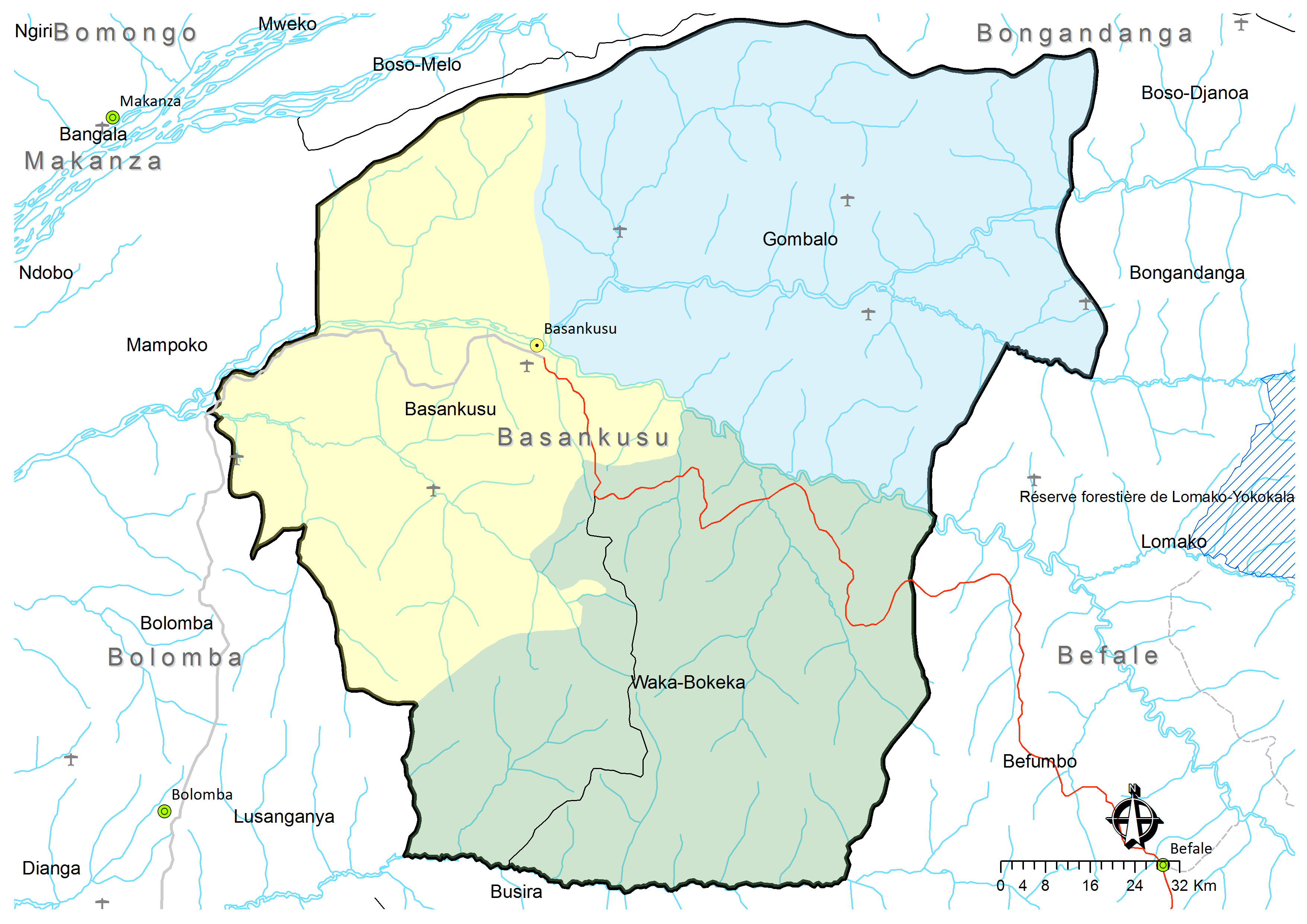
- ^ a b c Territoire de Basankusu: Carte administrative (Map). Cellule d'Analyses des Indicateurs de Développement (CAID). Archived from the original on 30 May 2018.
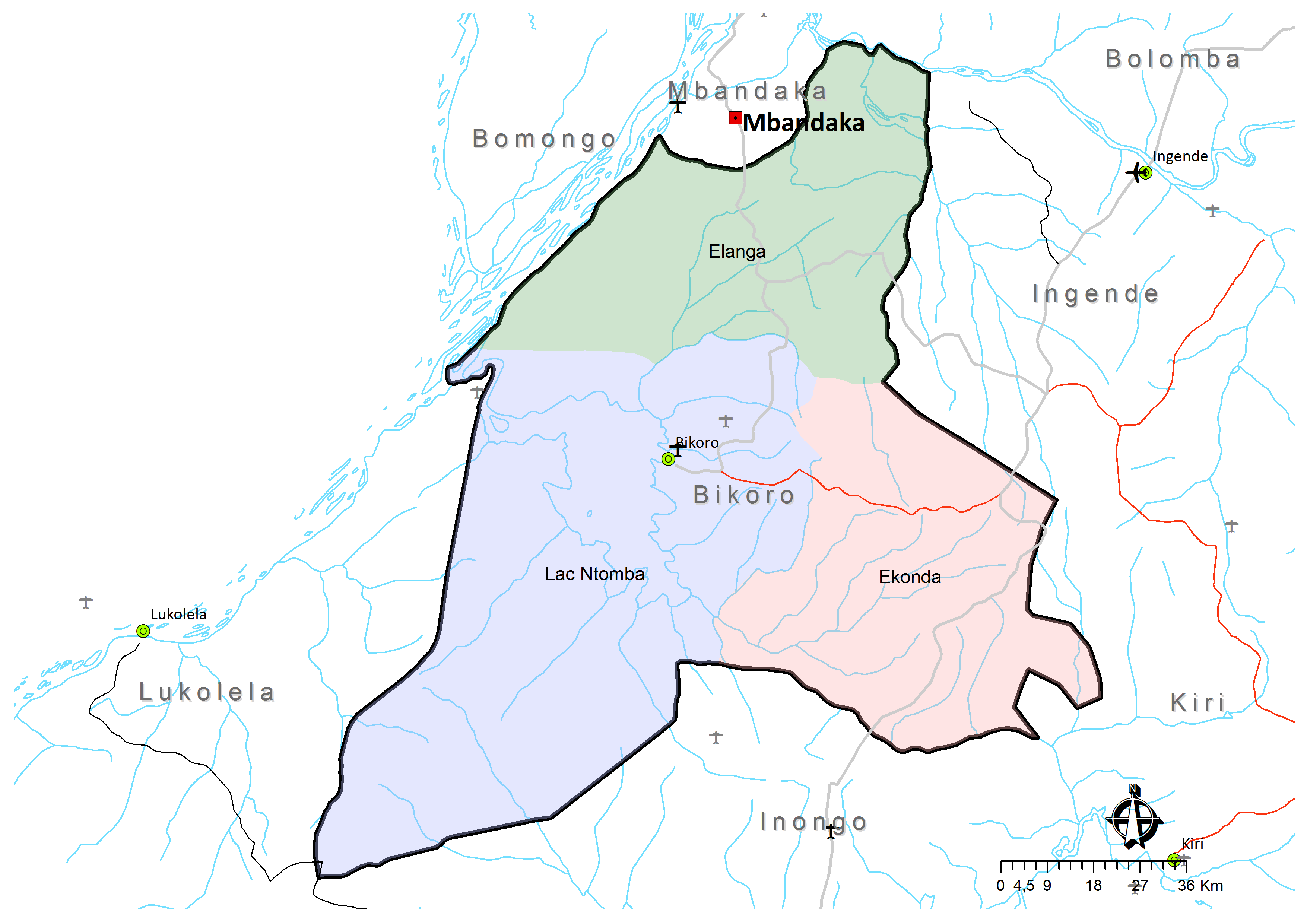
- ^ a b c Territoire de Bikoro: Carte administrative (Map). Cellule d'Analyses des Indicateurs de Développement (CAID). Archived from the original on 30 May 2018.
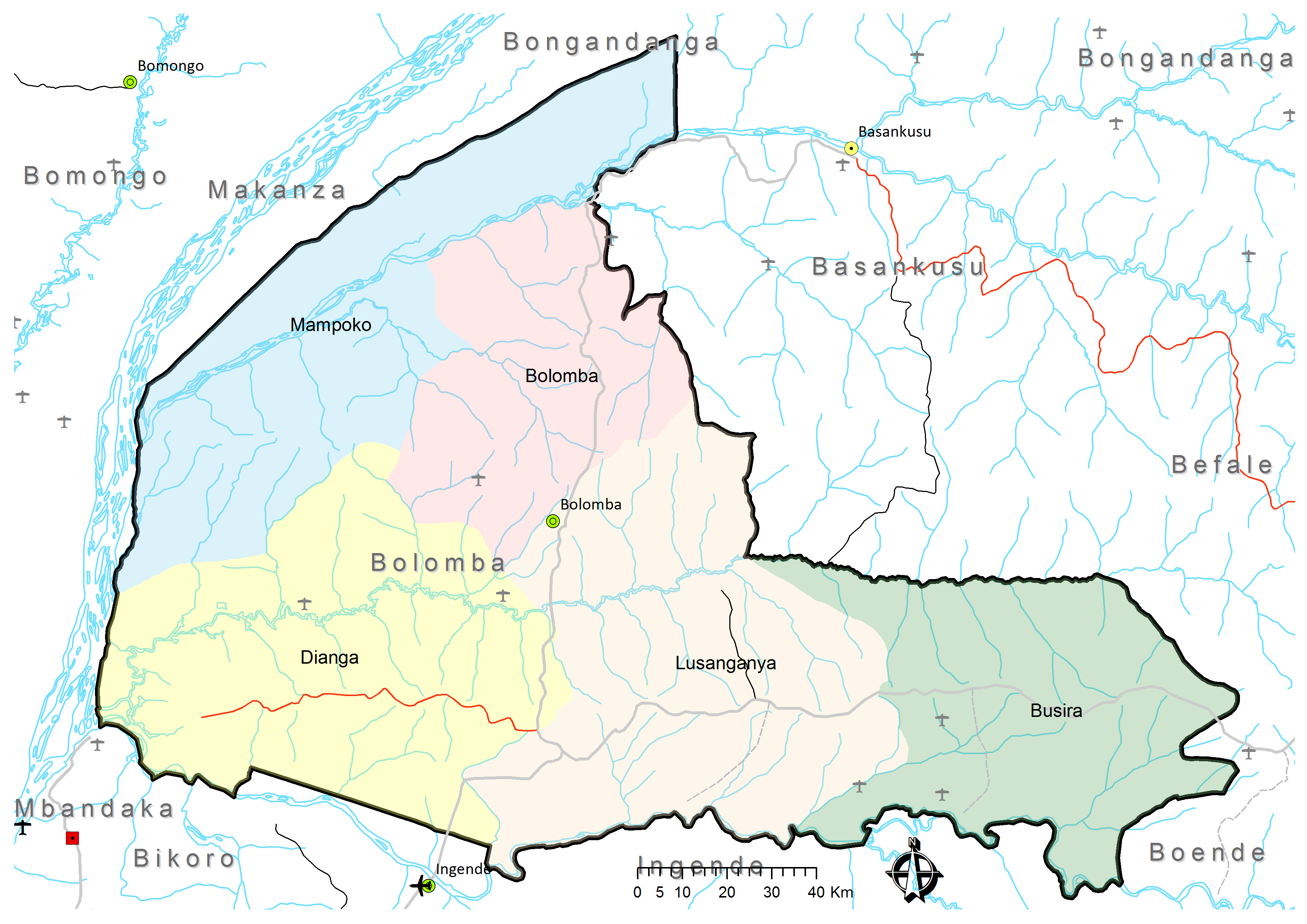
- ^ a b c d e Territoire de Bolomba: Carte administrative (Map). Cellule d'Analyses des Indicateurs de Développement (CAID). Archived from the original on 30 May 2018.
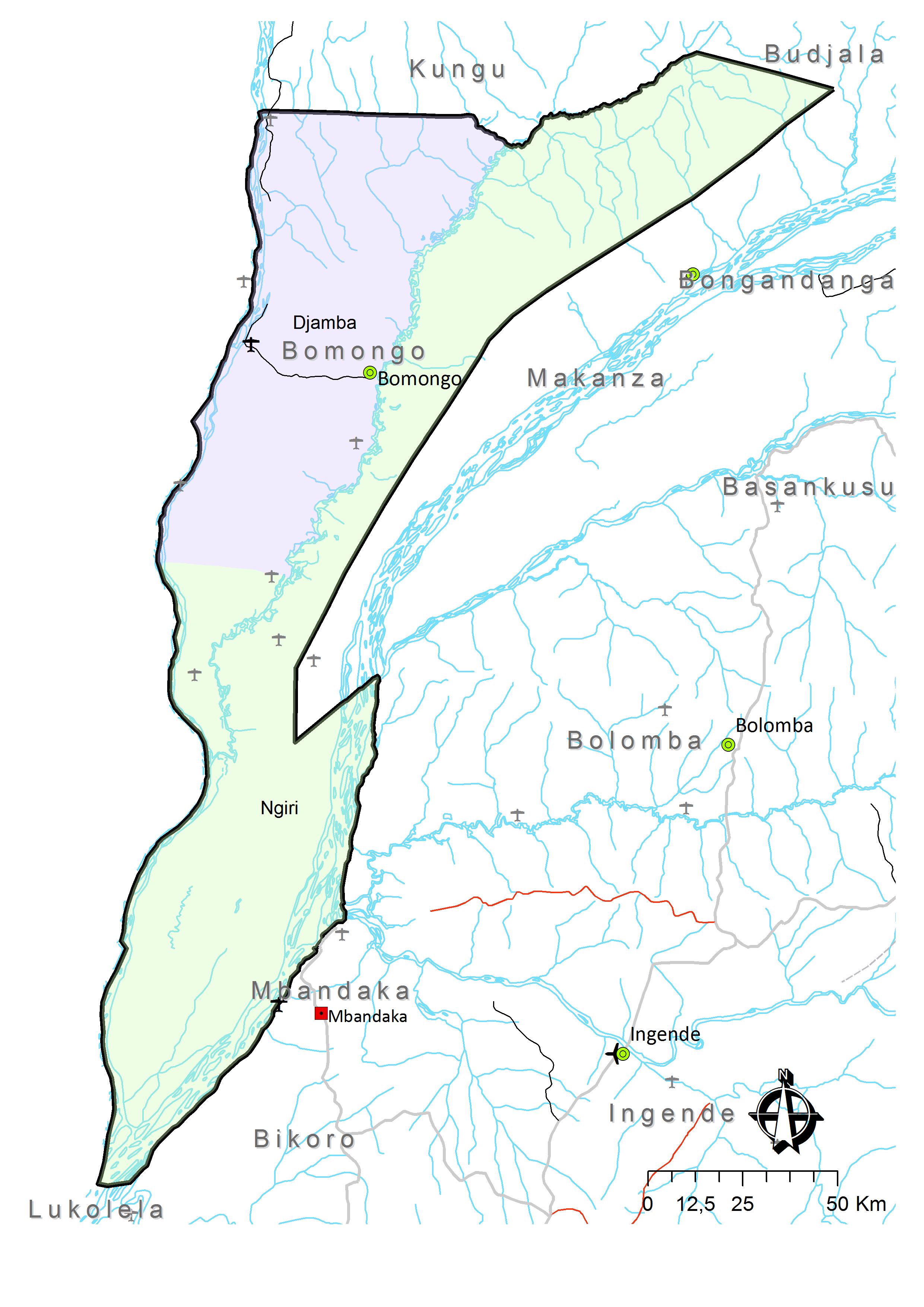
- ^ a b Territoire de Bomongo: Carte administrative (Map). Cellule d'Analyses des Indicateurs de Développement (CAID). Archived from the original on 30 May 2018.
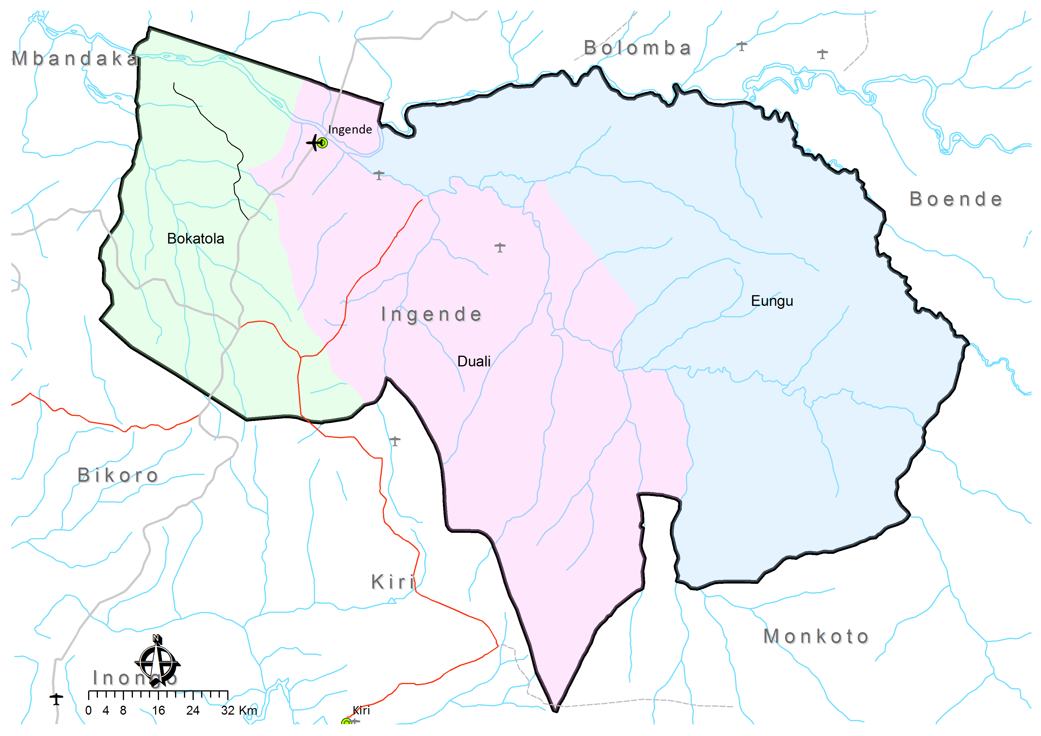
- ^ a b c Territoire de Ingende: Carte administrative (Map). Cellule d'Analyses des Indicateurs de Développement (CAID). Archived from the original on 21 May 2018.
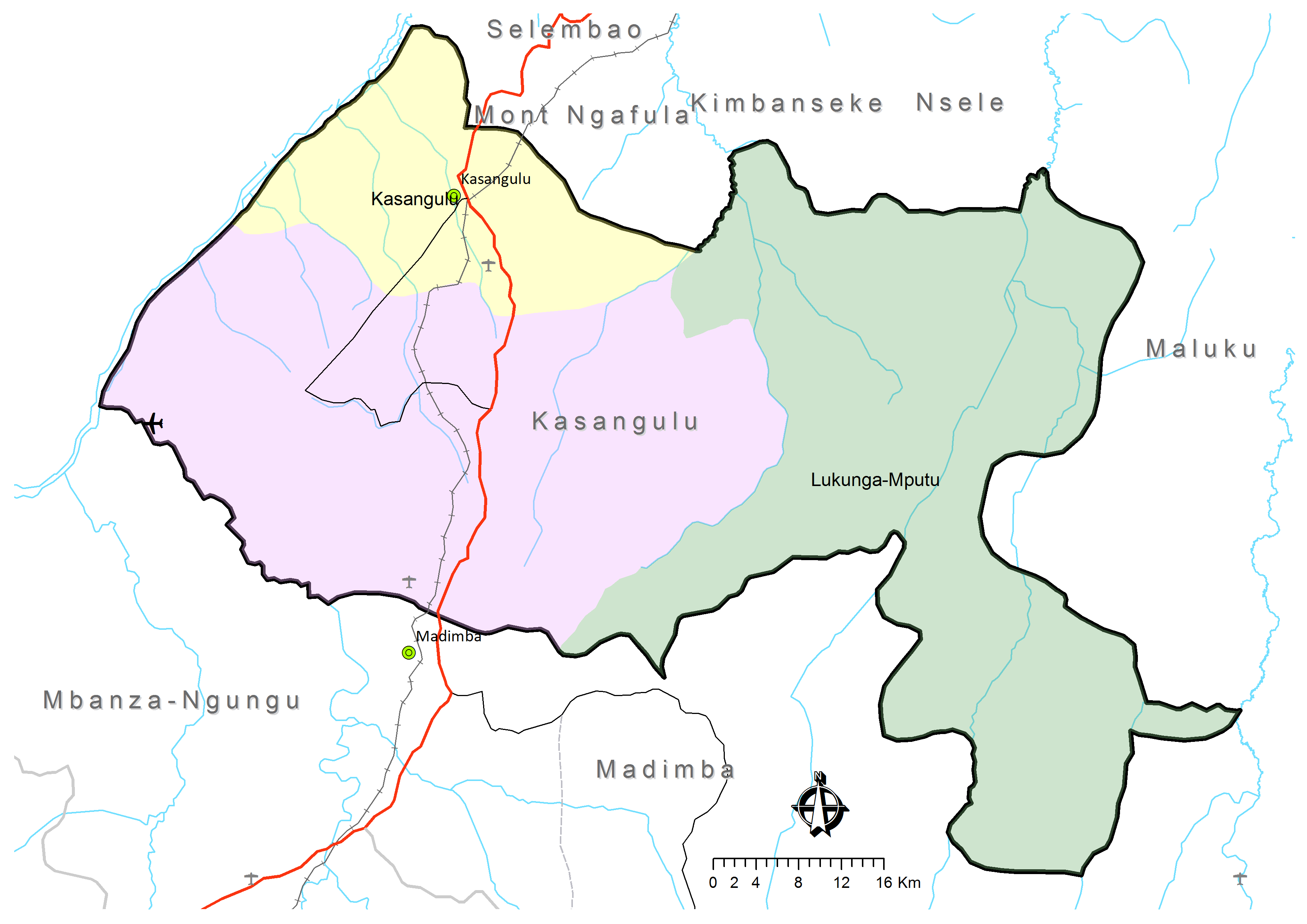
- ^ a b c Territoire de Kasangulu: Carte administrative (Map). Cellule d'Analyses des Indicateurs de Développement (CAID). Archived from the original on 30 May 2018.
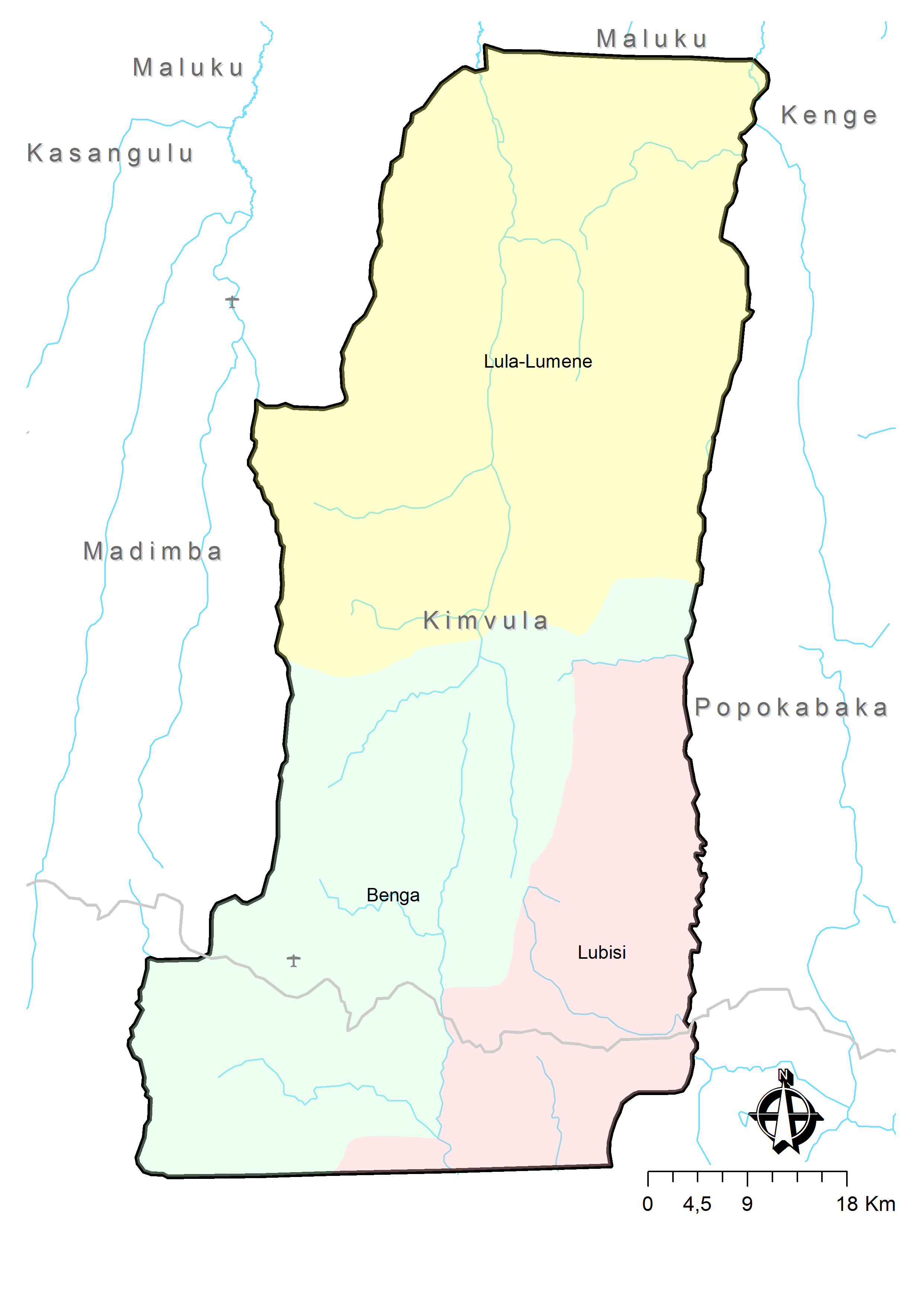
- ^ a b c Territoire de Kimvula: Carte administrative (Map). Cellule d'Analyses des Indicateurs de Développement (CAID). Archived from the original on 30 May 2018.
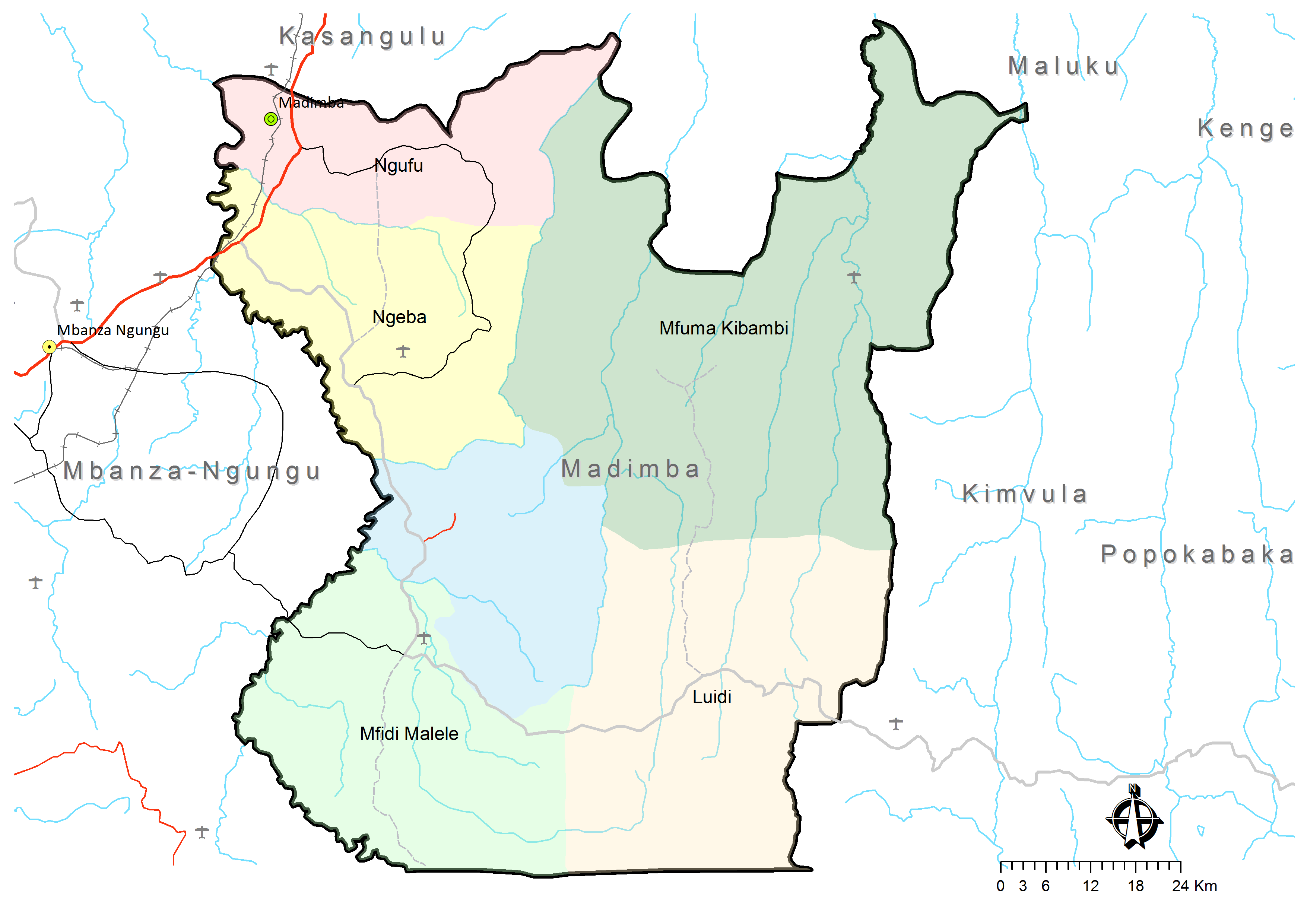
- ^ a b c d e f Territoire de Madimba: Carte administrative (Map). Cellule d'Analyses des Indicateurs de Développement (CAID). Archived from the original on 30 May 2018.
External links
- Blaes, X. (October 2008). "Découpage administratif de la République Démocratique du Congo" (PDF). PNUD-SIG. Archived from the original (PDF) on 2010-04-01. Retrieved 2011-12-09.