Athens metropolitan area
Athens metropolitan area | |
|---|---|
Interactive map of Athens metropolitan area | |
| Coordinates: 37°59′03″N 23°43′41″E / 37.98417°N 23.72806°E | |
| Geographic region | Central Greece |
| Administrative region | Attica |
| Area | |
| • Metro | 2,929 km2 (1,131 sq mi) |
| Highest elevation | 1,413 m (4,636 ft) |
| Lowest elevation | 0 m (0 ft) |
| Population (2021)[1] | |
| • Metro | 4,638,281 |
| • Metro density | 1,584/km2 (4,101/sq mi) |
| Time zone | UTC+2 (EET) |
| • Summer (DST) | UTC+3 (EEST) |
| Telephone | 21 |
| Vehicle registration | Yxx, Zxx, Ixx |
| Major airport(s) | Athens International Airport |
The Athens metropolitan area (Greek: Μητροπολιτική Περιοχή της Αθήνας) spans 2,928.717 km2 (1,131 sq mi) within the Attica region and consists of 58 municipalities plus parts of East Attica and West Attica, having reached a population of 4,773,179 according to the 2021 census.[2] The municipalities of Athens and Piraeus both serve as the two metropolitan centres of the Athens metropolitan area.[3]
According to the Hellenic Telecommunications and Post Commission, the Athens metropolitan area consists of all areas with a dialing code of 21 and includes areas such as Salamina, Elefsina, Kifissia, Mandra, Magoula, Aspropyrgos, Pallini, Agios Stefanos, Dionysos, Parnitha, Koropi, Vari, Vouliagmeni, Voula and the Athens International Airport.[4][5][6][7]
Administration
The Athens Urban Area, also known as Greater Athens,[8] consists of 40 municipalities, 35 of which make up what was referred to as the former Athens Prefecture municipalities, located within 4 regional units (North Athens, West Athens, Central Athens, South Athens); and a further 5 municipalities, which make up the former Piraeus Prefecture municipalities, located within the regional unit of Piraeus. The Athens Municipality forms the core and centre of Greater Athens, which in turn consists of the Athens Municipality and 40 more municipalities, divided into four regional units, accounting for 2,611,713 people (in 2021) within an area of 361 km2 (139 sq mi). The regional units of Central, North, South, and West Athens, Piraeus and parts of East[9] and West Attica[10] regional units combined make up the continuous Athens Urban Area.[10][11][12]
Athens-Piraeus urban area municipalities
This is a list of the main municipalities as well as municipal units which comprise the main bulk of the Athens-Piraeus urban area (dark red):
| Municipality | Municipal units | Population (2021)[13] | Area (km²) | Density per km² | Regional unit |
|---|---|---|---|---|---|
| Athens | 643,452 | 39 | 16,499 | Central Athens | |
| Dafni-Ymittos | Dafni | 23,431 | 1.375 | 17,040 | |
| Ymittos | 10,455 | 0.975 | 10,700 | ||
| Galatsi | 57,909 | 4.026 | 14,477 | ||
| Ilioupoli | 76,730 | 12.7 | 6,042 | ||
| Kaisariani | 26,269 | 7.8 | 3,368 | ||
| Nea Filadelfeia-Nea Chalkidona | Nea Filadelfeia | 25,198 | 2.850 | 8,841 | |
| Nea Chalkidona | 9,760 | 0.800 | 12,200 | ||
| Vyronas | 59,134 | 9.2 | 6,428 | ||
| Zografou | 69,874 | 8.5 | 8,220 | ||
| Agia Paraskevi | 62,147 | 7.9 | 7,867 | North Athens | |
| Chalandri | 77,102 | 10.8 | 7,139 | ||
| Filothei-Psychiko | Filothei | 7,370 | 2.301 | 3,200 | |
| Neo Psychiko | 10,671 | 1.000 | 10,670 | ||
| Psychiko | 9,595 | 2.776 | 3,456 | ||
| Irakleio | 50,494 | 4.638 | 10,890 | ||
| Kifisia | Kifisia | 48,700 | 25.937 | 1,880 | |
| Ekali | 5,574 | 4.332 | 1,287 | ||
| Nea Erythrea | 18,604 | 4.831 | 3,851 | ||
| Lykovrysi-Pefki | Lykovrysi | 9,705 | 1.950 | 4,977 | |
| Pefki | 21,293 | 2.176 | 9,785 | ||
| Marousi | 71,830 | 12.938 | 5,552 | ||
| Metamorfosi | 30,174 | 5.502 | 5,484 | ||
| Nea Ionia | 64,611 | 4.421 | 14,610 | ||
| Papagou-Cholargos | Cholargos | 31,304 | 3.950 | 7,925 | |
| Papagou | 13,962 | 3.375 | 4,137 | ||
| Penteli | Melissia | 23,618 | 3.956 | 5,970 | |
| Nea Penteli | 6,916 | 3.230 | 2,141 | ||
| Penteli | 5,076 | 28.878 | 175.8 | ||
| Vrilissia | 32,417 | 3.856 | 8,407 | ||
| Agios Dimitrios | 71,664 | 4.949 | 14,480 | South Athens | |
| Alimos | 43,174 | 5.909 | 7,306 | ||
| Elliniko-Argyroupoli | Argyroupoli | 33,312 | 8.228 | 4,049 | |
| Elliniko | 16,715 | 7.127 | 2,345 | ||
| Glyfada | 89,597 | 25.366 | 3,532.2 | ||
| Kallithea | 97,616 | 4.749 | 20,560 | ||
| Moschato-Tavros | Moschato | 25,322 | 2.325 | 10,890 | |
| Tavros | 14,339 | 2.125 | 6,748 | ||
| Nea Smyrni | 72,853 | 3.524 | 20,670 | ||
| Palaio Faliro | 64,863 | 4.574 | 14,180 | ||
| Agia Varvara | 26,759 | 2.425 | 11,030 | West Athens | |
| Agioi Anargyroi-Kamatero | Agioi Anargyroi | 32,283 | 3.200 | 10,090 | |
| Kamatero | 29,179 | 5.950 | 4,904 | ||
| Aigaleo | 65,831 | 6.450 | 10,210 | ||
| Haidari | 47,051 | 22.655 | 2,076.8 | ||
| Ilion | 84,004 | 9.453 | 8,886 | ||
| Peristeri | 133,630 | 10.05 | 13,300 | ||
| Petroupoli | 60,146 | 6.597 | 9,117 | ||
| Keratsini-Drapetsona | Keratsini | 75,721 | 7.601 | 9,962 | Piraeus |
| Drapetsona | 13,815 | 1.725 | 8,009 | ||
| Korydallos | 61,248 | 4.324 | 14,160 | ||
| Nikaia-Agios Ioannis Rentis | Nikaia | 88,077 | 6.649 | 13,250 | |
| Agios Ioannis Rentis | 15,411 | 4.524 | 3,406 | ||
| Perama | 25,628 | 14.729 | 1,740 | ||
| Piraeus | 168,151 | 10.865 | 15,476 | ||
| Acharnes | Acharnes | 100,857 | 146.41 | 689 | East Attica |
| Thrakomakedones | 7,312 | 3.550 | 2,060 | ||
| Vari-Voula-Vouliagmeni | Voula | 31,497 | 8.787 | 3,584 | |
| Vouliagmeni | 4,332 | 5.805 | 746 | ||
| Fyli | Ano Liosia | 35,047 | 38.447 | 911.57 | West Attica |
| Zefyri | 9,901 | 1.400 | 7,072 | ||
Metropolitan area municipalities
This is a list of additional municipalities and municipal units which are considered parts of the Athens metropolitan area according to EETT (bright red):
| Municipality | Municipal units | Population (2021)[13] | Area (km²) | Density per km² | Regional unit |
|---|---|---|---|---|---|
| Dionysos | Agios Stefanos | 10,597 | 8.136 | 1,302 | East Attica |
| Anoixi | 6,592 | 4.582 | 1,439 | ||
| Dionysos | 7,021 | 69.36 | 327.9 | ||
| Drosia | 7,837 | 2.201 | 3,561 | ||
| Kryoneri | 5,318 | 4.531 | 1,174 | ||
| Rodopoli | 2,110 | 9.550 | 221 | ||
| Stamata | 2,901 | 18.950 | 153.1 | ||
| Kropia (Koropi) | 30,817 | 102.0 | 302.1 | ||
| Markopoulo Mesogaias | 21,722 | 81.84 | 265.4 | ||
| Paiania | Glyka Nera | 11,877 | 9.238 | 1,286 | |
| Paiania | 16,159 | 43.92 | 367.9 | ||
| Pallini | Anthousa | 2,158 | 3.865 | 558.3 | |
| Gerakas | 33,856 | 6.633 | 5,104 | ||
| Pallini | 23,445 | 18.93 | 1,239 | ||
| Rafina-Pikermi | Rafina | 14,620 | 18.979 | 770.3 | |
| Pikermi | 7,707 | 21.522 | 358.1 | ||
| Spata-Artemida | Artemida | 21,924 | 18.653 | 1,175.4 | |
| Spata | 12,991 | 55.042 | 236.02 | ||
| Saronikos | Palaia Fokaia | 3,025 | 22.944 | 131.8 | |
| Vari-Voula-Vouliagmeni | Vari | 16,717 | 22.633 | 738.61 | |
| Aspropyrgos | 31,381 | 101.98 | 307.72 | West Attica | |
| Elefsina | Elefsina | 24,971 | 18.455 | 1,353.1 | |
| Magoula | 5,176 | 18.134 | 285.4 | ||
| Fyli | 3,209 | 69.28 | 46.32 | ||
| Mandra-Eidyllia | Mandra | 12,365 | 205.770 | 60.091 | |
| Salamis | Ampelakia | 6,985 | 15.169 | 460.5 | Islands |
| Salamis | 30,235 | 80.992 | 373.31 | ||
Climate
Due to its large area metropolitan Athens has a variety of climates. The largest part of the Athens metropolitan area has a hot-summer Mediterranean climate (Köppen climate classification: Csa), while some areas of the Athens Riviera, some areas of the Thriasio Plain and some areas in the west have a hot semi-arid climate (Köppen climate classification: BSh). According to the meteorological stations of the National Observatory of Athens and the Hellenic National Meteorological Service areas in the north have wetter and colder winters. Dionysos has a January average high of around 9 °C and an average low of 4 °C, while Parnitha mountain has a January average high of around 4 °C and an average low below 0 °C.[14][15][16] Areas in the south have very mild winters with Nea Smyrni recording a January average high of 15 °C and an average low of 9 °C.[14][17]
The highest summer maximum temperatures are recorded in the interior of the Athens Basin and also in west areas with Magoula, Nea Filadelfeia, Harokopio University and Salamina registering July mean maximum temperatures as high as 36.5 °C.[18][19][14][20] Due to land breezes, summer nights can be particularly hot in the south and especially around Piraeus which records an average August low of around 27 °C.[14][21] The highest average annual temperature is recorded in Piraeus Port registering around 20.9 °C, while the lowest is recorded in Parnitha mountain with less than 11.0 °C.[14][22][23] Neos Kosmos is the warmest area of Downtown Athens with an average annual temperature of 20.2 °C and a hot semi-arid climate (Köppen climate classification: BSh) closely bordering a hot-summer mediterranean (Csa) climate. During July 2024 minimum temperatures remained over 30 °C (86 °F) for 12 consecutive days in metropolitan Athens, breaking all known records for any area in the country.[24][25]
The lowest average annual precipitation in metropolitan Athens is recorded in Piraeus Kallipoli with 304 mm, while the highest average annual precipitation is recorded in Parnitha mountain with around 720 mm.[14][26][27] The highest temperature ever recorded in the Athens metropolitan area was 48.0 °C in Elefsina and Tatoi on July 10, 1977 which according to the World Meteorological Organization was also the highest official temperature ever recorded in Europe until 2021.[28] The lowest temperature ever recorded was −12.0 °C in Parnitha mountain on January 9, 2017.[29] The highest minimum temperature of 32.9 °C (91 °F) was recorded on July 26, 2023 in Hellinikon.[30] Furthermore, Metropolitan Athens has experienced temperatures of 47.5 °C and over in four different locations.
Regarding the whole of the Attica peninsula, the lowest average annual precipitation is found in Anavysos, Athens Riviera with around 290 mm, while the highest average annual precipitation is found in Avlonas with around 910 mm.[31] Lavrio is the only area in mainland Attica that has never recorded an air frost according to the National Observatory of Athens station which operates since 2008.[32][14]
| Climate data for Downtown Athens (1991–2020), Extremes (1890–present) | |||||||||||||
|---|---|---|---|---|---|---|---|---|---|---|---|---|---|
| Month | Jan | Feb | Mar | Apr | May | Jun | Jul | Aug | Sep | Oct | Nov | Dec | Year |
| Record high °C (°F) | 22.8 (73.0) |
25.3 (77.5) |
28.2 (82.8) |
32.2 (90.0) |
37.6 (99.7) |
44.8 (112.6) |
42.8 (109.0) |
43.9 (111.0) |
38.7 (101.7) |
36.5 (97.7) |
30.5 (86.9) |
23.1 (73.6) |
44.8 (112.6) |
| Mean daily maximum °C (°F) | 13.3 (55.9) |
14.2 (57.6) |
17.0 (62.6) |
21.1 (70.0) |
26.5 (79.7) |
31.6 (88.9) |
34.3 (93.7) |
34.3 (93.7) |
29.6 (85.3) |
24.4 (75.9) |
18.9 (66.0) |
14.4 (57.9) |
23.3 (73.9) |
| Daily mean °C (°F) | 10.2 (50.4) |
10.8 (51.4) |
13.1 (55.6) |
16.7 (62.1) |
21.8 (71.2) |
26.6 (79.9) |
29.3 (84.7) |
29.4 (84.9) |
25.0 (77.0) |
20.3 (68.5) |
15.6 (60.1) |
11.6 (52.9) |
19.2 (66.6) |
| Mean daily minimum °C (°F) | 7.1 (44.8) |
7.3 (45.1) |
9.2 (48.6) |
12.3 (54.1) |
17.0 (62.6) |
21.6 (70.9) |
24.2 (75.6) |
24.4 (75.9) |
20.4 (68.7) |
16.2 (61.2) |
12.2 (54.0) |
8.7 (47.7) |
15.0 (59.0) |
| Record low °C (°F) | −6.5 (20.3) |
−5.7 (21.7) |
−2.6 (27.3) |
1.7 (35.1) |
6.2 (43.2) |
11.8 (53.2) |
16 (61) |
15.5 (59.9) |
8.9 (48.0) |
5.9 (42.6) |
−1.1 (30.0) |
−4.0 (24.8) |
−6.5 (20.3) |
| Average rainfall mm (inches) | 55.6 (2.19) |
44.4 (1.75) |
45.6 (1.80) |
27.6 (1.09) |
20.7 (0.81) |
11.6 (0.46) |
10.7 (0.42) |
5.4 (0.21) |
25.8 (1.02) |
38.6 (1.52) |
70.8 (2.79) |
76.3 (3.00) |
433.1 (17.06) |
| Average relative humidity (%) | 72.0 | 70.0 | 66.0 | 60.0 | 56.0 | 50.0 | 42.0 | 47.0 | 57.0 | 66.0 | 72.0 | 73.0 | 60.9 |
| Average ultraviolet index | 2 | 3 | 5 | 7 | 9 | 10 | 10 | 9 | 6 | 4 | 2 | 2 | 6 |
| Source 1: Cosmos, scientific magazine of the National Observatory of Athens[33] | |||||||||||||
| Source 2: Meteoclub[34][35] | |||||||||||||
| Climate data for Piraeus Hellenic National Meteorological Service (1981-2010) | |||||||||||||
|---|---|---|---|---|---|---|---|---|---|---|---|---|---|
| Month | Jan | Feb | Mar | Apr | May | Jun | Jul | Aug | Sep | Oct | Nov | Dec | Year |
| Mean daily maximum °C (°F) | 14.1 (57.4) |
14.4 (57.9) |
16.6 (61.9) |
20.3 (68.5) |
25.1 (77.2) |
29.9 (85.8) |
32.8 (91.0) |
32.9 (91.2) |
29.1 (84.4) |
24.2 (75.6) |
18.9 (66.0) |
15.4 (59.7) |
22.81 (73.06) |
| Daily mean °C (°F) | 11.1 (52.0) |
11.2 (52.2) |
13.3 (55.9) |
16.9 (62.4) |
21.4 (70.5) |
26.3 (79.3) |
29.0 (84.2) |
28.8 (83.8) |
25.2 (77.4) |
20.6 (69.1) |
15.8 (60.4) |
12.6 (54.7) |
19.35 (66.83) |
| Mean daily minimum °C (°F) | 8.2 (46.8) |
7.9 (46.2) |
10.0 (50.0) |
13.4 (56.1) |
17.7 (63.9) |
22.2 (72.0) |
24.8 (76.6) |
25.0 (77.0) |
21.5 (70.7) |
17.4 (63.3) |
12.9 (55.2) |
9.7 (49.5) |
15.89 (60.60) |
| Average rainfall mm (inches) | 41.95 (1.65) |
36.26 (1.43) |
34.09 (1.34) |
30.34 (1.19) |
15.95 (0.63) |
5.08 (0.20) |
5.56 (0.22) |
3.07 (0.12) |
11.37 (0.45) |
30.5 (1.20) |
58.87 (2.32) |
58.84 (2.32) |
331.9 (13.07) |
| Source: [36] | |||||||||||||
| Climate data for Athens metropolitan area (Record Highs) | |||||||||||||
|---|---|---|---|---|---|---|---|---|---|---|---|---|---|
| Month | Jan | Feb | Mar | Apr | May | Jun | Jul | Aug | Sep | Oct | Nov | Dec | Year |
| Record high °C (°F) | 25.9 (78.6) |
25.8 (78.4) |
30.3 (86.5) |
33.2 (91.8) |
40.6 (105.1) |
47.5 (117.5) |
48.0 (118.4) |
45.3 (113.5) |
41.6 (106.9) |
38.4 (101.1) |
31.6 (88.9) |
25.0 (77.0) |
48.0 (118.4) |
| Source: [37][38][39] | |||||||||||||
| Climate data for Attica (Record Highs) | |||||||||||||
|---|---|---|---|---|---|---|---|---|---|---|---|---|---|
| Month | Jan | Feb | Mar | Apr | May | Jun | Jul | Aug | Sep | Oct | Nov | Dec | Year |
| Record high °C (°F) | 25.9 (78.6) |
25.9 (78.6) |
30.3 (86.5) |
33.4 (92.1) |
40.6 (105.1) |
47.5 (117.5) |
48.0 (118.4) |
46.2 (115.2) |
41.6 (106.9) |
38.4 (101.1) |
32.2 (90.0) |
25.8 (78.4) |
48.0 (118.4) |
| Source: [40][41][42][43] | |||||||||||||
Economy
The Gross domestic product (GDP) of the region was 87.4 billion € in 2018, accounting for about 47% of the Greek economic output. GDP per capita adjusted for purchasing power was 28,000 € or 93% of the EU27 average in the same year. The GDP per employee was 99% of the EU average. Attica is the region in Greece with the highest GDP per capita.[44]
Transport
Urban transport
Road transport
Ferry transport
Air transport
References
- ^ "Census 2021". Retrieved 3 January 2023.
- ^ "Μόνιμος Πληθυσμός - ELSTAT". www.statistics.gr. Retrieved 2023-06-10.
- ^ "MASTER PLAN FOR ATHENS AND ATTICA 2021, pg 13, 24, 27, 33, 36, 89". Archived from the original on 21 March 2012.
- ^ Κειμενο ∆ημοσιας ∆ιαβουλευσης σχετικα με το εθνικο σχε∆ιο αριθμο∆οτησης (PDF), National Telecommunications and Postal Commission, May 2006, archived (PDF) from the original on 24 Jan 2022
- ^ "Κωδικοί τηλεφώνων ανά περιοχή στην Ελλάδα: Μάθετε τα πάντα". 25 January 2021. Archived from the original on 2023-01-02.
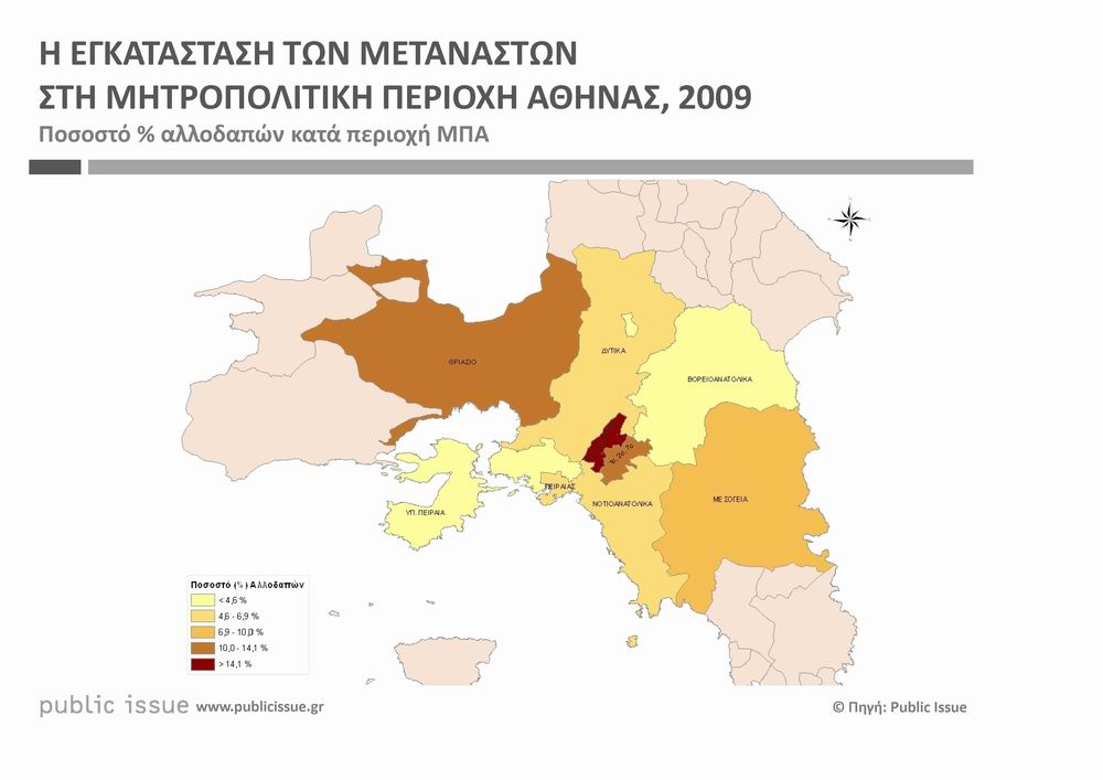
- ^ "image1". www.publicissue.gr. August 2010. Retrieved October 29, 2024.
- ^ "ΜΗΤΡΟΠΟΛΙΤΙΚΗ ΑΘΗΝΑ" (PDF). www.ita.org.gr. Retrieved October 29, 2024.
- ^ "Greater Athens (Greece): Municipalities – Population Statistics, Charts and Map". citypopulation.de. Archived from the original on 3 May 2020. Retrieved 2020-05-24.
- ^ "Concise Statistical Yearbook of Greece 2001 page 38, National Statistical Service of Greece" (PDF). Archived (PDF) from the original on 1 July 2019. Retrieved 26 August 2019.
- ^ a b "Αttikh". EraNET (in Greek). Archived from the original on 29 June 2019. Retrieved 8 August 2019.
- ^ "Monthly Statistical Bulletin Monthly Statistical Bulletin December 2012, Hellenic Statistical Authority, page 64" (PDF). Archived (PDF) from the original on 13 July 2020. Retrieved 29 August 2019.
- ^ "Statistical Yearbook of Greece 2001 page 72, National Statistical Service of Greece" (PDF). Archived (PDF) from the original on 1 July 2019. Retrieved 8 August 2019.
- ^ a b Cite error: The named reference
:0was invoked but never defined (see the help page). - ^ a b c d e f g "Monthly Bulletins". National Observatory of Athens. Retrieved 9 April 2023.
- ^ "Dionysos NOA station". National Observatory of Athens. Retrieved 9 April 2023.
- ^ "Parnitha NOA station". National Observatory of Athens. Retrieved 9 April 2023.
- ^ "Nea Smyrni NOA station". National Observatory of Athens. Retrieved 9 April 2023.
- ^ "NOA". Retrieved 7 May 2025.
- ^ "30 year period summer statistics of Nea Filadelfeia". Meteoclub. Retrieved 28 January 2018.
- ^ "Salamina NOA station". National Observatory of Athens. Retrieved 9 April 2023.
- ^ "Piraeus NOA station". National Observatory of Athens. Retrieved 9 April 2023.
- ^ "Parnitha NOA station". National Observatory of Athens. Retrieved 9 April 2023.
- ^ "Latest Conditions in Nea Smyrni, Athens".
- ^ "Piraeus 12 consecutive days over 30C minimums". Archived from the original on 2024-07-21. Retrieved 22 July 2024.
- ^ "Pireas Port 12 consecutive days minimum T over 30.0C". Archived from the original on 2024-08-31. Retrieved 29 September 2024.
- ^ "Parnitha NOA station". National Observatory of Athens. Retrieved 9 April 2023.
- ^ "Latest Conditions in Piraeus".
- ^ "World Meteorological Organization's World Weather & Climate Extremes Archive". wmo.asu.edu. Archived from the original on 4 August 2022.
- ^ "Parnitha record low". National Observatory of Athens. Archived from the original on 2018-07-24. Retrieved 9 April 2023.
- ^ "HNMS". Archived from the original on 2023-07-27. Retrieved 9 May 2024.
- ^ "Lavrio NOA station". National Observatory of Athens. Retrieved 9 April 2023.
- ^ "Το 'νέο' κλίμα της Αθήνας - Περίοδος 1991-2020". National Observatory of Athens. Archived from the original on 21 October 2021. Retrieved 3 July 2021.
- ^ "Το κλίμα της Αθήνας". www.meteoclub.gr. Archived from the original on 21 October 2021. Retrieved 3 July 2021.
- ^ "Το αρχείο του Θησείου". www.meteoclub.gr. Archived from the original on 4 May 2016. Retrieved 1 May 2016.
- ^ "Piraeus Urban Planning 1" (PDF) (in Greek). Pagkrati & Millioni (2017), NTUA. Archived from the original (PDF) on 2019-03-07. Retrieved 30 Sep 2019.
- ^ "HNMS" (PDF). Archived from the original (PDF) on 2017-12-19. Retrieved 11 October 2024.
- ^ "NTUA". Retrieved 11 October 2024.
- ^ "NOA". Retrieved 11 October 2024.
- ^ "HNMS" (PDF). Archived from the original (PDF) on 2017-12-19. Retrieved 11 October 2024.
- ^ "NTUA". Retrieved 11 October 2024.
- ^ "NOA". Retrieved 11 October 2024.
- ^ "46.2C Avlonas". Archived from the original on 2023-07-26. Retrieved 27 April 2024.
- ^ "Regional GDP per capita ranged from 30% to 263% of the EU average in 2018". Eurostat.